In early 2014, Katie Fite traveled through south central Idaho to document environmental abuse and degradation on public lands where raven killing projects were implemented by federal agencies in an attempt to “protect” sage grouse. Some of the photos she took have been omitted but are mentioned in emails sent to agency staff below. Here is what she found:
In summary, my memory of the three Raven Kill areas, as described in WWP’s comments on the WS EA, was confirmed in my recent site visit these areas.
Birch Creek: Intensive sheep grazing is destroying and killing the sage. Severe cattle impacts are present, as well. The area along Birch Creek is a complete nightmare of fencing – exclosures, pastures, water gaps, you name it. Plus very heavy human camping use in some areas, and roads roads, roads. There is a diversity in sage. Sagebrush of sufficient height for sage-grouse to nest in is actually limited in many areas – and the rapacious sheep grazing is destroying critical areas of taller sage – cows are breaking off sage in some areas, and understories are greatly depleted.. There are mima mounds with taller sage, and patches of more continuous big sage – but large areas do not have taller sage. The rapacious sheep grazing is killing and fragmenting sage in many areas.
BIrch Creek water is diverted for irrigation. So Birch Creek no longer reaches the sinks down on INL. As a result, water for sage-grouse is not present as far down the lower valley/plain as it historically was. Water appears to be piped a bit further down from where the water is diverted to east. There are a couple of wetted areas with exclosures – cows have been inside at least one of the exclosures, and I observed a black cow with medium green ear tags present.
First photo, grass on road right of way, vs. BLM land dirt.
Then photos of large beat out areas – and condition of understory and lack of residual cover.
4th photo is one of the innumerable water gaps on Birch Creek – this one is near the point of the diversion of the stream to the east. Note bent fence wire. Cattle have been inside the exclosure area here, through what appear to be purposefully bent wires. Everywhere sagebrush is variously eaten and/or shows signs of being broken off in past years.
Dead coyote remains (note feet cut off by human) are strewn around, providing carrion. IDFG and WS can clean up trapper (or perhaps WS own) carrion.
I cannot over-emphasize how much fencing, and how much roading, there is. Plus, there appears to be a whole separate wide sheep trail destruction area running separate from, and parallel to, one of the roads paralleling a western series of exclosures on Birch Creek.
Then, several photos showing feather remains from a sage-grouse. Location: 44 3′ 12.9″ N 112 51 47.6″ N Tail feathers, and various body feathers. Note conditions were extremely windy. The grouse may have collided with the fence, as I found a feather impaled on a wire. Dozens of feathers were a few hundred feet away, on the other side of a sheep trail. A vehicle had driven off road near the feathers. Toilet paper was present – visible in center background of photo with lots of little pale specks of grouse body feathers. I would later see toilet paper all over where sheep camps had been (photo series to follow).
Neither the feathers or the paper appeared to have been rained/snowed on.
Next to last photo is inside one of the small fenced wetted areas downstream from the main diversion of Birch Creek. Cattle use there, too in 2014 and in fact I observed a cow still present the next day.
It is clear that there are many, many MAJOR habitat problems here for any animal attempting to survive on public lands. Ravens are the least of the problems.
Wildlife Services and IDFG can busy themselves with cleaning up carrion, and not hauling more in. BLM must do something to reduce the severe fencing and human disturbance footprint and rapacious grazing (from both cows and sheep), and nightmare of roading.
Ravens should not be scapegoated for agency failure to properly manage habitats. Next I will send photos of what the sheep are doing to sagebrush on both BLM and some Forest lands in the area of the Birch Creek Kill Zone.
It is time agencies stop sitting back and allowing WS predator killing to occur on public lands. Instead, making simple management changes can dramatically improve habitat quality. Until agencies actually develop a site-specific plan that honestly addresses livestock, livestock facility, roading and other impacts. – we request that you do not allow WS to conduct any raven killing activities on public lands.
Here are photos of conditions I observed in another area of the Birch Creek Kill Zone on 4/13/14. I had camped up on Forest lands in Tyler Canyon to try to get out of the wind. As I was driving out of the Canyon in the morning, I observed sheep wool all over the place on sagebrush on the Forest, and fresh trampling and manure. Are sheep supposed to be grazing on Forest lands in the southern Lemhi Range?
First photo, tufts of white wool in sage. 43 59′ 47.5 N 112 54 59.9 W.
As I left the canyon, I observed a plume of dust from a truck driving on a road in the center of the valley. I then saw the truck was headed to a sheep camp that was off the same route I was driving. Sheep camp: 43 58′ 59.3″ N 112 46′ 4.19″W. It was a water truck, and had driven from the main road all through sage-grouse habitats to get to the sheep camp site.
Several dogs ran out of the sheep camp towards my car. I could also see a sheep tied up by a sheep wagon, and a young lamb, indicating more afterbirth predator subsidies. The camp and the water truck – were all pulled off in the sagebrush. I proceeded on past, and soon encountered a severely disturbed area of sagebrush.
The remainder of the photos are of the area past the sheep camp. 43 59′ 55.8″ N 112 51′ 19.6″ W amid the Raven Kill Zone. I also observed very fresh sage-grouse sign in this area – indicating birds were trying to use this area right as the sheep and severe disturbance footprint of the sheep, dogs, water truck, etc. was being imposed.
Large numbers of sheep are being watered in undisturbed sage areas – and apparently fed something out of feed bags. I will be sending you many more photos of sites like this. Often, there are many pieces of bag tops left on the ground (visible in several photos). BLM (and the Forest because in subsequent e-mails I will send you photos of Forest lands near the BLM boundary) – are allowing the sage-grouse nesting habitats to be torn to pieces – right when birds are lekking and nesting.
Here we are told by IDFG that the Kill Zone sage-grouse populations are crashing and ravens must die because a lot of ravens were seen. Further justification used is that the LWG (primarily rancher interests and agency staff looking out for rancher interests) wrote a letter a couple years ago supporting raven killing.
Yet BLM and the Forest are literally allowing the nesting cover to be stripped from on top of nesting sage-grouse hens – plus the habitat to be incrementally destroyed for a very long period of time – as this is a very unresilient, harsh, dry, windy landscape. Mature and old growth sagebrush plans may be 50-75 years old, or more.
The livestock disturbance footprint, and obvious livestock-caused habitat degradation impacts, in all the Raven Kill zones are overwhelming. Yet the LWGs are blindly ignoring the overwhelming evidence of severe grazing impacts.
Why are federal agencies allowing this abusive grazing to occur during the sage-grouse breeding season – in proximity to leks and nesting habitats when the grouse population is in perilous decline?
I continued on out towards the center of the valley from the recent sheep camp area, and encountered an old cemetery (from back when there had been water in Birch Creek down much further in the valley), and soon came to the INL boundary and retreated up a different route ( there are so may to choose from).
Enroute, I encountered what appeared to be an old sheep camp site, indicating the fate the current ones are likely to suffer. Cow grazing also appears to overlap the sheep impact zones.
I then encountered areas of severe sheep concentration where sheep had been killing sagebrush in the area of 43 57′ 11″ N 112 53′ 14.4 “W.
I also encountered obvious cattle damage to sagebrush in lands near Cedar Canyon, which apparently suffers both sheep and cattle impacts. Last several photos (before nesting platform).
The next to last photo is of what appears to be a sidehill that suffered severe livestock impacts in the past – note cheatgrass.
The last photo is of an obvious raptor nesting platform placed on Forest lands at 43 56 26.2 N 112 53 9.11 W.
No raptors were using it at present – there were old nest remains. Besides northern harriers in the Curlew country, I saw very few other raptors – only a hand full of buteos and 4 or so kestrels. It was very windy, but this is still a large dearth of raptors for all the country I visited. I saw not a single golden eagle.
Does the Forest have records on this and other platforms? Was it put up for ferruginous hawks? How are the Forest and BLM keeping track of species like ferruginous hawk that may be suffering serious impacts from fires and juniper treatment in Idaho?
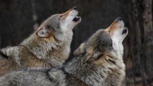
I saw a single raven, up on the Forest, near the Birch Creek Kill Zone. I saw 2 other ravens to the north several miles at a ranch.
Here are more photos of conditions in the Birch Creek Raven Kill Zone.
More sheep killing of sage. 44 2 30.9 N 112 53 14.9 W.
I also saw what looked like a small upland exclosure in the distance, and walked out to it. Location: 44 2 32.1″ N 112 53′ 17.4″ W.
Wires appeared to have been bent up to allow livestock access. There was still a noticeable difference between the sage inside and outside.
While walking along the fence, I saw lots of sage grouse feathers, and a big clump of feathers with bits of dried skin. It appears a grouse may have collided with the fence. 44 2 32.1 N 112 53 17.4 W.
First couple of photos are actually to the south- where Birch Creek used to flow prior to diversion. Severe cattle grazing is turning the former stream bottom soils into a dust bowl. There actually is some limited potential for a bit of mesic vegetation for brood rearing in a few sites – note green grass – but cattle grazing impacts here are so severe that no forbs seem able to survive.
Then, a dustbowl surrounding a livestock water trough.
Some of the insane roading and sheep trailing area.
Exclosure area, water gap areas, lots of soil erosion, roads and OHV camping.
My understanding is the sage-grouse hens are supposed to be moving their chicks up the valley as summer progresses. They confront a nightmare of intense human activity as they would attempt to do so.
Ravens are not the cause of these conditions, and the raven killing is a huge distraction from dealing with this sad situation in an integrated manner – which is essential to conserve sage-grouse. The entire Birch Creek Valley should be managed as an ACEC. Yet we are faced with a BLM GRSG DEIS that is so weak and meaningless that it does not even consider designating a single acre as an ACEC in the BLM Pref Alt. The Forest lands being trashed by the sheep (and cows elsewhere in the valley) should be part of a Zoological Area, as well, in a greatly revised Supplemental EIS process.
Further, it appears the destructive sheep grazing here on top of nesting sage-grouse is in violation of the Little Lost-Birch Creek MFP, see Attached page. WWP asks that this be immediately ended, and the sheep camp, dogs, water truck driving in and out and all over, sheep, etc. parked amid crucial habitats be immediately removed. No trailing on the sheep/cow freeway through here should be allowed, either. There is a good, paved road all the way up the valley and animals can readily be trucked. in fact, I believe a mega-load or two traveled the road.
Sage-grouse breeding season is March 1 to June 20th.
No cattle should be turned out anywhere during this period, either. Are any slated to be?
Ravens are being killed because BLM (and the Forest it appears by potentially allowing its lands to be abused by grazing as part of a BLM operation?) will not even follow its own MFP. The sheep sign all over the place was from late winter-spring to up to a day or two prior – I did not see the sheep- but perhaps they were up high eating snow – as the latest sign was towards the Forest in the north. Idaho Falls BLM has just allowed the sheep to trash the habitat all throughout this critical period for sage-grouse. No wonder the Birch Creek population is collapsing. Plus now there is the extreme recreational use on top of the brood rearing habitats as well as late nesting. Imagine being a grouse with couple day old chicks out on Birch Creek on Memorial Day weekend …
I have one or two more general Birch Creek degradation e-mails to send to you, and then will be sending BLM photos and e-mails about the conditions in the Twin Butte allotment area of the southern 8b Raven Kill Zone where Sen. Siddoway and others graze, where I did indeed see sheep, sheep, sheep, and it was so dusty, disturbed, full of dogs, herders, and just a plain wasted landscape that after a couple hours of breathing in sheep waste dust, I left. It is truly amazing grouse are still present there (I observed sign in several areas). They are doomed, for certain, unless radical management changes happen, and unless something is done to remove the cwg and recover sage.
Note the lack of avian flight diverters on the crumpled wires on the ground. As a sidenote, we will be inquiring of DOE/INL if all their towers of every sort have avian flight diverters. I could not see any while driving by one on a road outside the Kill Zone. Why were there no flight diverters?
The big long tank and halogeton and dirt are the inside of the manure-free big corral.
Also, a photo of a radio tower which dominates the landscape for a considerable distance.
So, in summary, the Birch Creek Kill Zone in many areas is a highly fragmented landscape – with fragmentation occurring at all scales – from the fragmentation of previously intact areas of sage from destructive concentration of domestic sheep, to the impacts of just having way, way, way too many cows and sheep all over the place out here, to a nightmare of fencing to a nightmare of roading (a considerable amount likely originating with the sheep operation in the first place) to many other kinds of human disturbances.
The sheep are systematically trashing the best condition and least disturbed areas of BLM lands. Although small in acreage, the Forest lands provide relatively higher elevation sagebrush habitats where some forbs still persist – yet the sheep are being run roughshod over portions of these lands adjacent to BLM. And all of this amidst the sage-grouse breeding season when grouse require large blocks of undisturbed habitat.
The actual habitat area where a sage-grouse could manage to nest in much of this area was, historically, limited to some degree by short-statured sage in portions of the valley and on alluvial fans, and by the too-steep slopes of the Lemhi and Beaverhead ranges.
So areas of taller sage for crucial nesting cover were not evenly dispersed across the landscape to begin with. Now, super-imposed on the natural habitat heterogeneity are a nightmare of human disturbances of all kinds.
Even if one believed that grazing here was somehow “sustainable” – there appear to be 10 to 20 more times as many livestock as the land can withstand, and BLM is violating its own land use plan by allowing the sheep to run all over the sage-grouse breeding habitat.
Plus the sheep and cows – when not outright killing the sage by eating it and bashing it, and decreasing the potential height of sage because it provides a big part of what the livestock are eating to survive – are further reducing the height and structural complexity of sage. Livestock are thus further limiting areas with suitable nesting cover.
And then there is the immense human footprint of barbed wire, roading, livestock and human disturbance along and surrounding Birch Creek. AND please recall that grouse from other areas to the south are supposed to be moving their chicks up the Birch Creek Valley after hatching … as someone at FG described to me long ago – marching their chicks up the valley.
So this public lands management mess is affecting a larger migratory sage-grouse population, even, than the birds associated with the leks in this area.
Immediate grazing changes must be made. What will the agencies do? Including right now, the rest of 2014, and beyond?
Beyond that, there is also need for drastic revision of the BLM mis-managed grazing all over DOE lands at INL. Idaho Falls District BLM has to come out of Dark Ages management, and stop allowing scorched earth grazing of the lower and mid elevation sagebrush lands, which we see everywhere we go – from Squaw Creek, Hawley Mountain, to Horse Creek in the Little Lost to Birch Creek and elsewhere. Later, I will be sending you photos of conditions on up Birch Creek, too and how the understory is allowed to be grazed to the nub. ACECs (with linked Forest Zoological Areas) are needed in all of these landscapes.
This all makes the federal agencies just sitting back and allowing Wildlife Services to pursue an avian poisoning campaign here even more outrageous. It is a distraction that attempts to divert attention away from the severe habitat degradation and mis-management.
On Monday, i visited the southern 8B Big Desert Raven Kill Zone. After driving by appalling soil erosion on private often barren ag. lands, I arrived at Cinder road, and started seeing BLM signs on the east side of the road saying Closed to Grazing use. There was a relatively recent burn, and efforts were being made to stabilize extremely erodible soils on the east side of the road – apparently. I decided to walk out into the east side burn. There had been some recent domestic sheep use throughout the area I walked in. It had been extremely windy the past 2 days, so tracks in the sandy soils were not visible.
There were some islands of unburned sage. Note mini-dunes. There was some halogeton present in many areas.
The sheep had pulled obviously seeded grasses out of the soil in some areas. (See clumps of pulled out grass in several photos). Manure was present in many areas. Some of the yanked out grass appeared to have been seeded native Indian ricegrass, paid for with public tax dollars.
What will be done about this? Whose sheep are responsible? How does BLM Keep track of whose sheep are where in this allotment with around a dozen permittees including various Siddoway operations?
Has any range health assessment and grazing evaluation ever been conducted in the Twin Butte allotment? If so, can you please provide it to us?
Have attached a screen map with GPS location in right side bar.
A little ways further along on Cinder Road, I saw an unburned area of sage, and observed two sheep wagons – one parked east of Cinder Road road, and one parked west, and soon started seeing many sheep, and literally dozens of areas where sheep wagons or water trucks had parked and areas had been intensively trampled and grazed to dirt. Many areas had suffered previous crested wheatgrass seeding, and the sheep appeared to be eating the sage that was present, and not the cwg. How is this being monitored? There were almost no forbs present – except annual weeds in places. I will send you several e-mails of these conditions. The situation facing the grouse in the country that I saw is very, very bleak. Grouse sign of all ages was present, including very recent scat. It appears the sheep are being run on top of nesting grouse to a very high degree. The entire area I later drove through has been severely degraded by sheep and is a dramatically depauperate landscape of exotic seeded grasses, some sage, almost zero forbs and biodiversity.
Here are more photos documenting conditions that I observed in the Big desert bB Southern Raven Kill Zone. Where I saw one raven, and a harrier or two. No other large avian species.
First photo – sheep camp past burn. Note powerline, too.
The rest are west of Cinder road. There are many, many little sheep camp pioneered roadlets not on the mapping.
Also, all kinds of crosscountry driving – by water trucks or to pioneer new sheep camp sites. The country is almost wall-to-wall sheep camp sites.
Halogeton and cheatgrass in some areas.
Broken, browsed sage. Extensive crested wheat that sheep appear to eat only reluctantly. Extensive trampling.
Except for the occasional poisonous death camas, and a hand full of phlox, native forbs are nearly non-existent.
It doesn’t take a rocket scientist to realize that it is difficult for a ground nesting bird that relies on a combination of residual grass cover and complex sage structure to screen nests to have a hard time surviving thousands of sheep being inflicted annually on top of nesting habitats like this. End result: See-through sage.
There are patches of areas with just various dried out flat annual weeds.
Please also review the studies that were done on sheep trampling long-billed curlew nests in the Black Canyon ACEC country. All kinds of wildlife are jeopardized by BLM’s reckless and unnecessary grazing of large herds of domestic sheep on top of nesting birds.
I did not get out of my car in some areas due to presence of Pyrenees sheep dogs and other dogs and sheep stench and general squalor.